*** START OF THE PROJECT GUTENBERG EBOOK 68494 ***
Transcriber’s Notes:
Italic text is enclosed in _underscores_. Boldface is enclosed in
=equals signs.=
The Table of Contents for this picture book is its “_Explanation of
Views Illustrated_”.
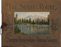
[Illustration: _MOUNT SHASTA FROM RESERVOIR LAKE._]
THE SHASTA ROUTE
ALONG the
SOUTHERN PACIFIC--THE ROAD of a THOUSAND WONDERS
[Illustration:
THE
SHASTA ROUTE
→IN ALL OF ITS GRANDEUR←
A SCENIC GUIDE BOOK
From San Francisco, California, to Portland, Oregon
On the Road of a Thousand Wonders
The illustrations shown in the following pages are all made expressly
for this book from photographs taken by special artists of the most
striking objects of interest, which abound to a remarkable extent along
the Southern Pacific Railroad, between San Francisco and Portland.
Great care was taken to select only such views as every traveler
actually sees along the line, so that the book truly forms a panorama
of scenic wonders which is unrolled every day before the eyes of
those who make this trip. Everyone desires to secure souvenirs of the
journey, and, knowing this, we have endeavored to make this volume
such a record of facts, and such a collection of beautiful, accurate
and attractive views, that it will be recognized by all as the most
appropriate and interesting souvenir of the journey. =For sale only en
route on the trains on the Shasta Route.=
EXCLUSIVE EDITION.
Copyrighted by Curt Teich & Co., Chicago.
Price $1.50
]
The charm of a trip along the Shasta Route of the Southern
Pacific, often termed “The Road of a Thousand Wonders,” is
recognized by the traveled world. It offers a succession of
grandeur and scenic beauty unexcelled by any railroad trip
in America.
_EXPLANATION OF VIEWS ILLUSTRATED_
MOUNT SHASTA FROM RESERVOIR LAKE (COVER)
This is one of the most famous views of this imperial mountain peak.
THE FERRY BUILDING
From the Ferry Building, at the foot of Market Street, the ferry boats
of the Southern Pacific take the traveler across San Francisco Bay
to Oakland Pier. The Ferry Building, erected in 1896 at a cost of
$1,000,000, is the water gate of San Francisco, where rail and tide
meet. There is scarcely a minute in the day when there is not a ferry
either arriving at or departing from some one of the ferry slips.
VIEW OF SAN FRANCISCO, SHOWING THE HARBOR, OAKLAND, AND MOUNT DIABLO IN
THE DISTANCE
San Francisco, the starting point of this journey, is the largest and
best known of the cities on the Pacific Coast. This bird’s eye view of
lower San Francisco, the Ferry Building and San Francisco Bay, shows
the splendid body of water facing the city. This Bay is seventy miles
long and from three to ten miles wide, and has an area of four hundred
and fifty square miles. Vessels of all descriptions, and from all
parts of the globe, populate San Francisco harbor, which is the pride
and marvel of all navigators. Yerba Buena Island is seen on the left,
++the trans-bay cities of Oakland, Berkeley and Alameda, and ferryboat
landings in the middle distance, while in the distance is seen Mount
Diablo.
OAKLAND, CALIFORNIA
Oakland, the third largest city in California is but eighteen minutes
from San Francisco via the Southern Pacific’s fine transbay steamers.
With its fine harbor facilities, Oakland is rapidly growing as a
commercial center, carrying on an extensive coastwise and foreign
trade. Its position on the east side of the bay, makes it a great
railroad terminal for all lines from the north, south and east.
As a community of homes, Oakland has a well deserved fame, for its
setting is picturesque and the climate nears perfection.
Oakland has many attractive parks and public playgrounds. Lake Merritt,
near the Civic Center is a natural water-park, and state game reserve,
where thousands of wild ducks make their winter home, an unusual sight,
indeed. Boating may be enjoyed every day in the year.
Oakland’s City Hall, with its massive tower, is the tallest building in
California, its height being 377 feet.
FERRY BOAT “CONTRA COSTA”
This ferry carries Southern Pacific trains and passengers between
Port Costa and Benicia, crossing the Carquinez Straits. The distance
is about a mile and requires about twenty minutes. The ferry was
constructed as a sister ship to the ferry “Solano” and is the largest
ferry in the world. It is 433 feet long, cost $450,000, and has a
capacity of 36 cars and two engines.
LASSEN PEAK, LASSEN VOLCANIC NATIONAL PARK
Lassen Peak, California, is the latest scene of volcanic activity on
the Pacific Coast, adding another point of interest along “The Road of
a Thousand Wonders.” Lassen Peak with its elevation of 10,577 feet, can
be seen from the car windows of the “Shasta Route” trains, and can be
visited from Red Bluff or Redding by automobile.
SACRAMENTO RIVER AND MT. SHASTA FROM CASTELLA
This is one of the finest views in the canyon, with the mighty form of
Mt. Shasta in the background. The great white cap extends 14,444 feet
above the sea. The foothill counties tributary to this valley are rich
in gold and other minerals, while the rich soil of the entire valley
is adapted to raising of a most diverse variety of crops. The upper
canyon of the Sacramento River constantly presents to the traveler an
ever-changing scene of astounding splendor.
CASTLE CRAGS IN SACRAMENTO CANYON
Castle Crags, in the Sacramento Canyon, are great granite rocks, rising
close beside the track, to a height of 4,000 feet. Their vertical
strata splintered into a hundred parapets, makes this a scene never to
be forgotten. Beyond the Crags is Castle Lake at an elevation of 7,245
feet, and from this point appears the rounded summit of Mt. Shasta,
silver against the turquoise sky; a watch tower of the world, gazing
ever toward the eternal.
MOSSBRAE FALLS AT SHASTA SPRINGS
Here one of the enormous streams which have their origin in the melting
snows of Mt. Shasta, divides itself into a myriad of little waterways
before reaching the top of a wooded semi-circular cliff, from which
point it tumbles into the Sacramento River, a hundred feet below,
forming Mossbrae Falls, as they appear like a thousand springs born
under the rocky ground.
SHASTA SPRINGS, CALIFORNIA
Shasta Springs, near the base of Mount Shasta, is one of the best-known
all-the-year-around resorts in the world. Here the train stops long
enough for a drink of the famous sparkling Shasta water, real soda
water. This resort is noted for its scenic beauty and its health-giving
water.
CANTARA LOOP, 18TH CROSSING, SACRAMENTO RIVER, CALIFORNIA
The train spends five hours crossing and recrossing the Sacramento
River. This loop was devised to get out of the canyon and up on the
plateau where stands Mt. Shasta, with its snowy summit, as seen from
the car windows; nothing could be a more glorious tribute to the
marvelous skill of the modern railroad engineer, than the obstacles met
with and overcome in building a railroad through this rugged country.
SISSON, AT THE BASE OF MOUNT SHASTA
At this point the traveler finds himself at the base of the mountain,
and if he desires, can arrange a genuine Alpine mountain climbing trip.
The town stands at the base of the mountain and a road runs to the edge
of the timber line, which has made possible an ascent of the mountain
in a single day. The wonderful view from the summit, 14,444 feet above
the sea, is bounded only by the curvature of the world’s disc, and
there is not a finer view to be had anywhere.
PANORAMA OF MT. SHASTA AND BLACK BUTTE
There are numerous volcanic cones scattered throughout this part of
California. One of the best-known is Black Butte, also called Muirs
Peak. Its cone is almost perpendicular to a height of almost 6,000
feet, close to the base of Mt. Shasta--black, bare and desolate, an
extinct volcano, with half a dozen craters in plain view. Mt. Shasta
is an extinct volcano, one of the highest peaks on the North American
Continent. Its snows and glaciers feed hundreds of streams which thread
the wild region in every direction. These wild regions are a paradise
for the sportsman and lover of nature. Grizzly, black and cinnamon bear
abound, elk, deer and mountain sheep are plenty, as well as a great
variety of smaller game. The streams are alive with trout.
MOUNT SHASTA FROM EDGEWOOD
Here is one of the favorite view points of this great snow-capped
mountain and where the majestic grandeur of the mountain is most
apparent. Edgewood, as the name suggests, is literally the edge of the
forest. From this point to the summit of the Siskiyous there is very
little timber.
MT. McLOUGHLIN FROM UPPER KLAMATH LAKE
The Klamath Country has no superior as a pleasure realm for the
sportsman and camper, and of unusual interest to tourists. Much of this
region is still a wilderness, full of the charm of mountain and forest.
Its marches are breeding grounds for wild fowl; its clear streams and
broad lakes are full of lusty, hard-fighting trout, and in its forests
roam deer, bear and cougars. Mount McLoughlin, the highest peak in
southern Oregon, is 9,760 feet above sea level.
WIZARD ISLAND, CRATER LAKE NATIONAL PARK
Crater Lake lies in the heart of the Cascade Range, in southern Oregon,
its surface 6,177 feet above sea level. As its name suggests, it is the
crater of an extinct volcano. Crater Lake has been sounded to a depth
of 1,996 feet and declared by scientists to be the deepest inland body
of water in the world. Rising almost sheer from the water’s edge, the
rim of the lava cliffs attain at places a height of 2,000 feet. From
Crater Lake Lodge, on the rim of the lake, the opposite shore is six
miles away. Wizard Island is a perfectly preserved cinder cone rising
nearly 1,000 feet above the lake. You may climb the slaggy timbered
cone of Wizard Island and descend one hundred feet into its crater
which is five hundred feet across.
LOOP TUNNELS 14 AND 15 IN SISKIYOU MOUNTAINS
This picture represents one of the difficulties of railroads through
this rugged mountain range and shows elevation is overcome by the
use of tunnels. A tunnel is cut through the rocks; a circuit is made
leading back to the same point at a higher elevation and another tunnel
is cut directly over the first one. The traveler will find this a most
interesting view as the train winds its way through these mountains.
GOLD RAY DAM, SHOWING TABLE MOUNTAIN AND ROGUE RIVER
Table Rock is familiar in Indian history as the place where Captain
Jack of the Modoc Indians made his last stand; was captured and hung
at Old Fort Klamath, ending the historical Modoc war. Snow-capped Mt.
Pitt, rising to an altitude of 9,760 feet, is visible from this point.
HELL GATE, ROGUE RIVER
This picture shows the character of the upper stretches of this
splendid trout stream. Anglers cross the continent for the joys of
fishing this stream. The line of the Shasta Route from Medford to
Crater Lake follows this canyon and affords many beautiful views.
COW CREEK CANYON
Despite its unromantic title, this canyon has few rivals in the
attractiveness of its scenery. For a long way, the tracks run parallel
to the stream, which races in rapid rivalry with the train. Its rugged
walls on every hand form grotesque outlines, suggesting weird figures
to the imagination of a nature-loving mind.
THE WILLIAMETTE RIVER, OREGON
The Southern Pacific “Shasta Route” follows for 150 miles, the
beautiful Williamette River, and from the car windows, may be glimpsed
views of its wooded banks, its gleaming reaches and winding course that
will delight the beholder. The Williamette Valley through which it
flows is the principal valley of Western Oregon.
MOUNT HOOD FROM LOST LAKE
This mountain is often spoken of as the “Pride of Oregon.” Its
uppermost peak reaches an altitude of 11,225 feet and is plainly
visible from many points on this part of “The Road of a Thousand
Wonders.” While this grand mountain is easy to climb, the ascent is
steep and the alpenstock and rope are used to aid one in his upward
journey. On the top one finds a region of perpetual snow, but the view
is indescribably grand. The trip to the summit is one of the most
popular trips out of Portland.
PORTLAND, OREGON. MOUNT HOOD IN DISTANCE
Portland, often termed the “Rose City,” has many natural advantages
and points of interest to the traveler. This popular name is derived
from the city’s beautiful parks and homes, where roses are in abundance
everywhere. A trip up the Columbia River from Portland will leave an
impression on the traveler never to be forgotten. Mountain climbing and
ocean bathing are popular sports that help to make Portland a favorite
stopping point.
[Illustration: (map)
SOUTHERN PACIFIC LINES
SUNSET, OGDEN AND SHASTA ROUTES
AND CONNECTIONS
]
[Illustration: FRONT VIEW OF FERRY BUILDING, SAN FRANCISCO, 125,000
PERSONS PASS THROUGH ITS PORTALS DAILY.]
[Illustration: SAN FRANCISCO AND BAY, OAKLAND, BERKELEY AND ALAMEDA IN
DISTANCE]
[Illustration: VISTA OF BEAUTIFUL LAKE MERRITT, OAKLAND]
[Illustration: FERRY BOAT “CONTRA COSTA”]
[Illustration: LASSEN PEAK--LASSEN VOLCANIC NATIONAL PARK]
[Illustration: SACRAMENTO RIVER AND MT. SHASTA, FROM CASTELLA]
[Illustration: CASTLE CRAGS IN SACRAMENTO CANYON]
[Illustration: MOSSBRAE FALLS AT SHASTA SPRINGS]
[Illustration: SHASTA SPRINGS]
[Illustration: CANTARA LOOP, 18TH CROSSING, SACRAMENTO RIVER]
[Illustration: SISSON AT THE BASE OF MOUNT SHASTA]
[Illustration: PANORAMA OF MOUNT SHASTA AND BLACK BUTTE]
[Illustration: MOUNT SHASTA FROM POINT NEAR EDGEWOOD]
[Illustration: KLAMATH LAKE AND MT. McLOUGHLIN]
[Illustration: WIZARD ISLAND, CRATER LAKE]
[Illustration: LOOP TUNNELS 14 AND 15 IN SISKIYOU MOUNTAINS]
[Illustration: GOLD RAY DAM, SHOWING TABLE MOUNTAIN AND ROGUE RIVER]
[Illustration: HELL GATE, ROGUE RIVER]
[Illustration: COW CREEK CANYON]
[Illustration: WILLIAMETTE RIVER]
[Illustration: MOUNT HOOD, FROM LOST LAKE]
[Illustration: PORTLAND, OREGON, MOUNT HOOD IN DISTANCE]
*** END OF THE PROJECT GUTENBERG EBOOK 68494 ***
The Shasta route in all of its grandeur - A scenic guide book from San Francisco, California, to Portland, Oregon on the road of a thousand wonders
Download Formats:
Excerpt
Italic text is enclosed in _underscores_. Boldface is enclosed in
=equals signs.=
The Table of Contents for this picture book is its “_Explanation of
Views Illustrated_”.
[Illustration: _MOUNT SHASTA FROM RESERVOIR LAKE._]
From San Francisco, California, to Portland, Oregon
The illustrations shown in the following pages are all made expressly
for this book from photographs taken by special artists of the most
striking objects of interest, which abound to a remarkable extent along...
Read the Full Text
— End of The Shasta route in all of its grandeur - A scenic guide book from San Francisco, California, to Portland, Oregon on the road of a thousand wonders —
Book Information
- Title
- The Shasta route in all of its grandeur - A scenic guide book from San Francisco, California, to Portland, Oregon on the road of a thousand wonders
- Author(s)
- Southern Pacific Company
- Language
- English
- Type
- Text
- Release Date
- July 11, 2022
- Word Count
- 2,305 words
- Library of Congress Classification
- F850.5
- Bookshelves
- Browsing: Art & Photography, Browsing: History - American, Browsing: Travel & Geography
- Rights
- Public domain in the USA.
Related Books
The Argonauts of California: being the reminiscenses of scenes and incidents that occurred in California in the early mining days
by Haskins, Charles Warren
English
3030h 2m read
The pioneers of Unadilla village, 1784-1840
by Halsey, Francis W. (Francis Whiting), Halsey, Gaius Leonard
English
1301h 45m read

Adobe days
by Bixby Smith, Sarah
English
918 hours read

California illustrated
by Letts, J. M. (John M.)
English
1392h 6m read

The gold hunters
by Borthwick, John David
English
1646h 53m read

Six months in the gold mines
by Buffum, E. Gould (Edward Gould)
English
823h 46m read