The Project Gutenberg eBook of Ye antient wrecke--1626, by Charles W.
Livermore
This eBook is for the use of anyone anywhere in the United States and
most other parts of the world at no cost and with almost no restrictions
whatsoever. You may copy it, give it away or re-use it under the terms
of the Project Gutenberg License included with this eBook or online at
www.gutenberg.org. If you are not located in the United States, you
will have to check the laws of the country where you are located before
using this eBook.
Title: Ye antient wrecke--1626
Loss of the Sparrow-Hawk in 1626. Remarkable preservation and
recent discovery of the wreck
Authors: Charles W. Livermore
Leander Crosby
Release Date: May 14, 2023 [eBook #70759]
Language: English
Produced by: Steve Mattern, Robert Tonsing and the Online Distributed
Proofreading Team at https://www.pgdp.net (This file was
produced from images generously made available by The
Internet Archive)
*** START OF THE PROJECT GUTENBERG EBOOK YE ANTIENT WRECKE--1626 ***
Yᵉ Antient Wrecke.—1626.
LOSS
OF THE
SPARROW-HAWK IN 1626.
REMARKABLE PRESERVATION
AND
RECENT DISCOVERY OF THE WRECK.
BOSTON:
PRINTED BY ALFRED MUDGE & SON,
34 School Street.
1865.
[Illustration: Draught of the Pilgrim Ship Sparrow-Hawk.
BODY, SHEER, AND HALF BREADTH PLAN.
_Dimensions.—Length 40 feet; Breadth 12 feet, 10 inches; Depth 9
feet, 7 1-2 inches._]
THE ANCIENT WRECK.
CHAPTER I.
Introductory Sketch.—Removal of the Hull to Boston.—Communication
from Messrs. Dolliver and Sleeper.—Statement of D. J. Lawlor,
Esq.—Model and Draught.
The wreck of the Sparrow-Hawk, which was discovered in 1863, may
be justly regarded as one of the greatest curiosities of the age.
This ship sailed from England for Virginia, in the fall of 1626,
with a large number of emigrants. After a long passage, she went
ashore on Cape Cod, and was there finally wrecked in a place then
known as Potanumaquut Harbor. Details of her passage and loss, and
the subsequent career of her passengers, have been preserved by
contemporary historians, from whom we shall make brief extracts in the
course of this work.
From the several local histories of the Cape, the posthumous edition
of Thoreau’s work, and an important note from Professor Agassiz, the
public have been made aware of the continuous geological changes of
that remarkable mass of drift, which we denominate “Cape Cod.” The
statements of these various authors are singularly elucidated and
confirmed by the history of “The Ancient Wreck.” The preservation and
discovery of the Sparrow-Hawk present facts of startling interest to
all,—but especially to those who are acquainted with the minutiæ of
early colonial history. They have in mind, and can readily recall with
us, the condition of the passengers, and the fate of their craft.
BENJAMIN DREW, Esq., of Chelsea, formerly of Plymouth, Mass., who had
the good fortune to see the wreck upon the beach at Orleans, before its
removal, presents us with the following remarks, which we here insert
as a suitable preface to the historical details:—
As I stood upon the shore, surveying with my friend[1] the remains
of the vessel which crossed the ocean two hundred and forty years
ago, imagination brought vividly before me the scenes of that early
voyage, the wrecking of the ship, and the providential escape of
the passengers and crew. Two hundred and forty years! yes, nearly
that long period had elapsed from the time of its protracted
and unsuccessful battling with the elements, and its subsequent
submergence in these sands of Nauset; and to-day the sea,
recovering the dominion it so long ago yielded to the land, has
disclosed to us the hull in all its fair proportions and symmetry
as it glided into the water from the builder’s hand, in the reign
of James the First.
The deep human sympathy which attaches to every scene where men
have fought or suffered,—which treasures every relic of the times
of the Pilgrims, invests this ancient wreck with a deep and
abiding interest. As we behold it, we seem to see Mr. Fells, Mr.
Sibsie, and the “many passengers” casting anxious eyes to the west;
for it is stormy weather, and the sea is rough, and they have been
six weeks afloat, “and have no water, nor beere, nor any woode
left;” and there is Captain Johnston “sick and lame of ye scurvie,”
so he can “but lye in his cabin dore and give direction;” and we
observe that the passengers are “mad for land,” and so through
“fear and unruliness,” compel the mariners “to stear a course
betweene ye southwest and norwest, that they might fall in with
some land, what soever it was, caring not.” And we recall, too, the
wild scene, when in the night they grated on the bar of an unknown
shore: the morning distress, when their cable parted and they beat
over the shoal,—their joy at drifting safely on a beach with only
the soaking of their cargo,—for they now discover that a plank has
started, and that the oakum has left the seams. We listen with
them to the strange voices of the red men; nor do we wonder that
they “stand on their guard:” but hark! these red men talk English,
and they tell of “New Plymouth” and “ye Governor.” So Mr. Fell and
Mr. Sibsie sit in the cabin here,—this same cabin!—and write to
the Governor; anon that worthy personage crosses the bay, bringing
spikes and material for repairs; he steps on board, and gives his
advice in the premises. They get a supply of corn, and repair
their ship, intending once more to make sail for Virginia; surely
they will find it this time! Before, “they had lost themselves
at sea;” but now they will take a new departure, and will soon
reach the land of their hopes. Not yet, my worthy friends,—your
tight, “serviceable” craft, now afloat, must be driven upon the
eastern side of the inner harbor, and hopelessly wrecked; you must
sojourn with the Pilgrims; and the Sparrow-Hawk, giving a name to
“Old Ship Harbor,” must lie for centuries under the sand and under
the salt-marsh; successive generations of Doanes shall swing the
scythe, and toss the hay, over her forgotten grave; but, in due
time, when these rocky, wooded islands, shall have sunk
“Beneath the trampling surge,
In beds of sparkling sand,”
your ship shall stand revealed again,—timbers and planks all
sound, the “occome” vanished from her seams, and “ye spikes” and
all other iron dissolved away; but we shall find your old sandals,
and the beef and mutton bones which you picked when you bade your
vessel a last good-by; and we shall feel a kindred satisfaction
in re-lighting the long-extinguished fires in these venerable
tobacco-pipes which you forgot to take away; and we shall send
your rudder for a while to the Exchange in State Street; and that,
and all the timbers and planks which you feel so sorry to leave,
we shall,—Mr. Fells, and Mr. Sibsie, and Capt. Johnston, by your
leave,—remove to a dry locality, and there, at our leisure, explore
the privacy of your cabin, and listen to your conversation with
Samoset and Governor Bradford.
If the “Advance,” which was shut in by Arctic ice, and abandoned
by Elisha Kent Kane, should some day be sent adrift in a contest
of icebergs, float into the Atlantic, and be towed into harbor, we
can readily imagine the interest with which she would be regarded.
If the “tossut” remained, who would not be anxious to creep
through it into the sacred precincts so long the home of the great
adventurer,—the abode, likewise, of Hans, and Ohlsen, and Morton,
“Whose latitudinous eye
Beheld the billows roll,
’Neath the long summer’s genial sky,
Around the northern pole?”
What crowds would come from all parts to see the famous brig!
But here is the hull of a ship of more worthy fame than the
Advance,—one which crossed the Atlantic while Boston was inhabited
by Indians; when this continent was, indeed, the _new_ world,—a
ship which came freighted with passengers, who became, by force
of circumstances, residents with, and, of course, friends of, the
Pilgrim Fathers; and who long retained in their Virginia homes a
sense of gratitude for favors received in the time of their trial.
May those days of mutual good will return!
CHARLES W. LIVERMORE, Esq., of this city, a member of the City Council,
and LEANDER CROSBY, Esq., of Orleans, a well-known resident of the
immediate vicinity of Old Ship Harbor, with a laudable desire to
preserve so remarkable a relic, have removed the hull to Boston, and
had all the parts put together in proper order by Messrs. DOLLIVER
and SLEEPER, well known and experienced ship-builders. Thus will be
perpetuated a ship which sailed the ocean contemporary with the
Mayflower,—doubtless the only one of that remote age now existing on
the face of the earth. Truly, a most unique curiosity, and well worthy
the attention of all men.
Mr. Livermore requested Messrs. Dolliver and Sleeper to communicate in
writing all matters relating to the style of building, the condition of
the hull, and any other particulars which might be of interest. Those
gentlemen, having put planks and timbers together in their pristine
shape, have furnished the following information in accordance with the
request of Mr. Livermore:
BOSTON, AUGUST 17, 1865.
CHARLES W. LIVERMORE, ESQ.
_Dear Sir_,—While putting into their original position the various
portions of the ship so long buried at the Cape, we have, as you
requested, taken special note of her peculiarities, &c., and in
compliance with your desire send the following statement.
Notwithstanding the many years which this vessel has been exposed
to the fury of the elements, and to the action of the shifting
sands in which she has been buried, her outline has been remarkably
well preserved. Only a practised mechanical eye could detect a
little inequality in her sides, in consequence of her having had
a heel to port. We have replaced the keel, sternpost, stern-knee,
part of the keelson, all the floor timbers, most of the first
futtocks and the garboard strake on the starboard side; but the
stem and forefoot, the top timbers and deck are gone. Enough of
her, however, remains to enable us to form a fair estimate of her
general outline when complete. The model made by D. J. Lawlor,
Esq., embodies our idea of her form and size.
Her length on the keel when complete was twenty-eight feet ten
inches, and she had great rake of stem with a curved forefoot, and
the rake of her sternpost is four inches to the foot. The great
rake of her stem and sternpost makes her length on deck between
extremes about forty feet, and her depth about nine and one-half
feet. Her forward lines are convex, her after lines sharp and
concave, and her midship section is almost the arc of a circle.
Her breadth of beam was about twelve feet and her sheer two and
one-half feet, with a lively rise at both ends. She had a square
stern, and no doubt bulwarks as far forward as the waist; but the
outline of the rest of her decks was probably protected by an open
rail.
As ballast was found in her, she may have been deeper than we have
described her, or heavily sparred, for it is not customary to put
ballast in a vessel with a heavy cargo unless she is very crank.
We mean such a cargo as she probably carried from England. The rig
common to vessels of her size at the time she was built consisted
of a single mast with a lateen yard and triangular sail. There is a
hole in her keelson for the step of the mast.
No doubt her deck was flush, for trunks and houses are of modern
invention, and that all her accommodations, and even her galley,
were below. It is probable that she had a small permanent cabin
aft, with a companion and binnacle; but we suppose, that, after
the cargo was stowed, a small platform deck was laid over it for
the crew. The hemp cables would be stowed forward below, with such
spare cordage and sails as might be required for a passage across
the Atlantic Ocean. The quarters for the crew, and the galley,
would be abaft these, and the entrance to them through the main
hatchway.
We notice by grooves in her floor timbers that she had limber-ropes
for the purpose of keeping a clean channel for the water to flow
toward the well. She unquestionably carried a small boat on deck,
and this, with the anchors, we suppose, were her only incumbrances.
Such we conceive to be a fair sketch of her, when she was complete.
We will now give a sketch of her as she is.
Her keel is of English elm, twenty-eight feet six inches long,
sided eight inches and moulded six; the floor timbers amidships are
seven feet one inch long, moulded seven inches and sided six, all
of oak hewn square at the corners and fastened through the keel
with one-inch oak treenails wedged in both ends. The first futtocks
overlap the floor-timbers about two feet, placed alongside of them,
forming almost solid work on the turn of the bilge, with a glut
or chock below each of them, but they were not fastened together.
She has not any navel timbers. We suppose that the joints of the
second futtocks overlapped in the same style as those below them.
As already stated, her stem and forefoot are gone; but a part of
her sternpost, and her stern-knee entire, are left. The sternpost
is mortised into the keel, and has been bolted through it and
the knee; but the iron has been oxidized long since. Instead of
deadwood aft she has seven forked timbers, the longest four feet
in the stem, with a natural branch on each side, and six inches
square. Some of these were half fayed to the keel, but none of them
were fastened. Through these the planking was treenailed. Part of
the keelson is now in its place; it is sided ten inches and moulded
eight, and was fastened to the keel with four iron bolts, driven
between the floor-timbers (not through them) into the keel.
Her breadth at present, at four feet two inches depth, from the
outside of the timbers, is eleven feet six inches, but when
planked, as already stated, it was no doubt twelve feet. She
had only three strakes of ceiling, all the rest of the timbers
were bare; but she had no doubt a stout clamp for her deck-beams
to rest upon and partner-beams as a support to her mast. Her
planking was two inches thick, of English oak, fastened with oak
treenails. Most of the planks are ten inches wide. The keel has
been cut to receive the lower edges of the garboards, which had
been spiked to it as well as treenailed through the timbers. The
starboard garboard strake is now in its place; and this is the
only planking we have put on, for the other strakes are somewhat
warped. Her outline, however, is perhaps more clearly defined than
if she had been planked throughout. It seems to us that after her
floor-timbers were laid and planked over, that the other timbers
were filled in piece by piece as the planking progressed, which
is still a favorite mode of building in some ports of England,
and were not jointed together and raised entire before planking.
By the appearance of the planks they have been scorched on the
inside and then suddenly saturated in water for the purpose of
bending them into shape, as a substitute for the modern mode of
steaming. The planks and treenails which have not been used by us
are preserved with care, and may be seen by those who wish a more
minute description of her construction. We suppose she had a heavy
planksheer or covering-board, and that her deck, like her planking,
was of English oak. We consider her model superior to that of many
vessels of the same size and even larger, which have been recently
built in Nova Scotia, and which may be seen in this port every
summer.
Yours truly,
DOLLIVER & SLEEPER.
With a desire to furnish ship-builders, and others interested in naval
construction, a plan of the ship, D. J. LAWLOR, Esq., naval architect,
has constructed a model of the hull, including the upper works, as they
must have originally existed. Mr. Lawlor’s scientific attainments, of
which the Government has availed itself in the construction of some of
the finest ships in our navy, have enabled him to reproduce in a model
the original lines of the hull,—showing perfectly the position and
shape of those portions which were worn away before its complete burial
in the sand. A draught from this model is on the second page of this
work.
A written statement accompanies Mr. Lawlor’s model, and his views, it
will be seen, coincide with those of Messrs. Dolliver and Sleeper.
The statement of Mr. Lawlor is as follows:
CHELSEA, AUG. 22, 1865.
C. W. LIVERMORE, ESQ.:
_Dear Sir_,—I have examined the Pilgrim ship, and find her quite
a curiosity in naval architecture, so different are her model
and proportions from those of sea-going vessels of the present
day. So much of her hull remains entire, that I did not find it a
difficult task to produce the lines, and complete a perfect working
model, which I send you herewith. I might furnish you with an
exact list of measurements, tonnage, &c., and point out the more
remarkable peculiarities of her construction; but those who may
have an opportunity to see the ship will obtain a far better idea
of the ancient style of building than I could hope to give by any
verbal description, however minute. She must have been an easy
sea-boat, and, for that early day, well adapted to the carrying of
passengers. The pleasure of observing and studying so ancient and
unique a specimen of ship-building has more than repaid the time
and attention I have been able to bestow upon it.
Yours, resp’ly,
D. J. LAWLOR.
An inquiry naturally suggests itself, By what means has a wreck, so
perfect that a “working model” could be constructed from it, been so
long preserved? Ordinarily, wrecks, being exposed to the direct action
of the winds and waves, soon break up and disappear. How does it happen
that this wreck formed an exception? That it was preserved by being
embedded and buried in the sand, has been already intimated. The causes
which at first operated to bury and conceal, and, at length, by their
continued action brought the wreck to light, will be considered in the
following chapter.
CHAPTER II.
Geological Changes of the Cape.—How they affected the
Wreck.—Effects of Single Storms.
A shore composed of the geological formation known as “drift,” and
directly exposed to the action of the sea, is doomed to undergo many
and rapid changes. By comparing the map, inserted on the next page, of
Cape Cod as it was at the time of its discovery, with the modern map,
the great changes made on the eastern coast by winds, waves and tides
will be at once made apparent.
[Illustration:
1. Site of former entrance to Potanumaquut or old ship harbor. The
locality of the old ship is represented in black.
2. Present entrance to Chatham harbor.
3. Island Ledge.
4. Webb’s island.
5. Namskachet creek. ]
In regard to the geological changes, we present here a short extract
from the recently published and highly entertaining work of Thoreau:
“Between October, 1849, and June of the next year, I found
that the bank [in Truro] had lost about forty feet in one place,
opposite the lighthouse, and it was cracked more than forty feet
from the edge at the last date, the shore being strewn with the
recent rubbish. But I judged that generally it is not wearing away
here at the rate of more than six feet annually.... The general
statement of the inhabitants is, that the Cape is wasting on both
sides, but extending itself on particular points on the south and
west, as at Chatham and Monomoy Beaches, and at Billingsgate, Long
and Race Points. James Freeman stated in his day that above three
miles had been added to Monomoy Beach during the previous fifty
years, and it is said to be still extending as fast as ever. A
writer in the Massachusetts Magazine, in the last century, tells
us that ‘when the English first settled upon the Cape, there was
an island off Chatham, at three leagues’ distance, called Webbs’
Island, containing twenty acres covered with red cedar or savin.
The inhabitants of Nantucket used to carry wood from it;’ but he
adds that in his day a large rock alone marked the spot, and the
water was six fathoms deep there. The entrance to Nauset harbor,
which was once in Eastham, has now travelled south into Orleans....
“On the eastern side the sea appears to be everywhere encroaching
on the land.... The bars along the coast shift with every storm.”
In the hurricane of April, 1851, in which Minot’s Ledge lighthouse was
swept away, many and great changes took place on the eastern side of
the Cape. A deep and spacious entrance was made into Chatham harbor,
which still continues to be very advantageous to the towns of Harwich
and Orleans; but the subsequent extension of bars, from an island lying
in the direction of Chatham, now prevents the business portion of that
place from deriving that benefit from the new opening which they at
first received.
Thoreau thus speaks of what fell under his own observation, during his
last visit to Cape Cod:
“We ourselves observed the effect of a single storm with a high
tide in the night, in July, 1855. It moved the sand on the beach
opposite [Highland] lighthouse to the depth of six feet, and three
rods in width as far as we could see north and south, and carried
it bodily off, no one knows exactly where, laying bare in one place
a rock five feet high, which was invisible before, and narrowing
the beach to that extent. There is usually, as I have said, no
bathing on the back side of the Cape, on account of the undertow,
but when we were there last the sea had three months before cast
up a bar near this lighthouse, two miles long and ten rods wide,
leaving a narrow cove, then a quarter of a mile long, between it
and the shore, which afforded excellent bathing. This cove had
from time to time been closed up as the bar travelled northward,
in one instance imprisoning four or five hundred whiting and cod,
which died there, and the water as often turned fresh, and finally
gave place to sand. This bar, the inhabitants assured us, might be
wholly removed, and the water six feet deep there in two or three
days.”—p. 142.
Along the eastern shores of Eastham and Orleans, the strong current
of the ebb and of a portion of the flood tide sets in a southerly
direction,—the undertow breaking up and carrying with it the sands
from the bottom. On reaching the mouth of the Potanumaquut harbor the
current, setting in, deposits this sand, thus prolonging the northern
point of the entrance-way; but, acting more directly on the southern
point, and aided by the retreating sea at ebb tide, the moving mass
of water must necessarily cut away the southerly bank,—so that the
northern point continually increasing in length and the southern point
shortening, or losing material, the harbor entrance is continually
travelling southward.
When the Sparrow-Hawk grounded for the last time within the northern
point, under the influence of a westerly gale, the sand must have
rapidly accumulated about her, in the manner and from the causes we
have just described. Still there would be, for a considerable time,
shallow waters about her after the sand had filled in the bay nearly
to her deck; and the ends of her timbers which were uppermost show at
this date the rounded form which we should expect to find from a flow
of waves and the attrition of the sands. But the wind is also busy on
the bleak shore of the Cape; the sand is blown inward from the top of
the sea line of cliffs; and in a few years from her first becoming
embedded, she must have been completely submerged. Above and around
her, at length the salt-marsh extended itself; but the place was well
known, and the name of “Old Ship Harbor” then obtained,—nor was this
name forgotten, although all knowledge of the ship itself had faded
from the memory of men.
In further illustration of our subject, we insert an extract from the
Massachusetts Historical Collections, vol. viii. p. 143. Boston: Munroe
& Francis, 1802:—
“Few towns in the county are so well provided with harbors as
Chatham. The first and most important, is on the eastern side of
the town, and is called Old harbour. It is formed by a narrow
beach, which completely guards it against the ocean. The haven on
the western side of this beach is extensive; but the harbour of
Chatham is supposed to reach not farther north than Strong island,
a distance of about four miles. Above that, the water, which is
within the limits of Harwich and Orleans, is known by other names.
The breadth of the harbour, is about three-quarters of a mile. Its
entrance, a quarter of a mile wide, is formed by a point of the
beach and James’ head, east of it on the main land. On the inside
of the beach are flats and salt marsh. There is also a piece of
marsh on the southern part of Strong island. These marshes are
covered during every tide.
“There are no rocks either within or near the harbour; but its
mouth is obstructed by bars, which extend east and southeast of
the point of the beach three quarters of a mile. On each side of
this mouth is a breaker,—one called the North, and the other the
South breaker. There are also several bars in the harbour within
the outer bars. These bars are continually shifting,—the causes
of which are storms and a strong current which sets in and out
of the harbour. At low water, there are seven feet on the outer
bars, common tides rising about six feet. North of them, the shore
is bolder. There is good holding ground in the harbour. At the
entrance, the bottom is sandy. Farther in there is a muddy bottom.
The depth at low water is about twenty feet.
“Not only do the bars alter, but the mouth of the harbour also is
perpetually varying. At present it is gradually moving southward
by the addition of sand to the point of the beach. The beach has
thus been extended above a mile within the course of the past forty
years.
“In the year 1626, there was an entrance into Monamoyick harbour,
opposite Potanumaquut, six miles north of the present mouth. The
ship mentioned by Prince[2] came in here, and was stranded on the
beach, where its ruins were to be seen about twenty years ago.
This part of the beach still bears the name of the Old Ship. The
entrance has been closed for many years. Several passages into
the harbour have been opened and shut since that time. At a late
period, there were two openings into the haven,—one of which, that
which now exists, was styled the Old harbour, and the other, the
New harbour.[3] Though the mouth of the New harbour is entirely
choked up with sand, yet the name, Old harbour, is still retained.
“It is not easy to give directions for sailing into so inconstant
a port. None but a pilot who is well acquainted with its yearly
variations can guide in a vessel with safety. On a signal being
made, however, boats are ready to put off from the shore, to yield
assistance. In a north-east storm, in which a pilot cannot leave
the land, a vessel, by getting to the south of the South breaker,
may, at present, ride with safety. But how long this will be true,
it is impossible to say.”
The following account of a tremendous storm and its effects, is from
the able work of the Rev. FREDERICK FREEMAN,—“History of Cape Cod;
Annals of Barnstable County and of its several towns”:—
“Among the remarkable events of this early period is recorded that
of a violent storm which did great damage, the tide rising twenty
feet perpendicular.” Hubbard and Morton say: “The Narragansets were
obliged to betake themselves to the tops of trees, and yet many of
them were drowned. Many hundred thousand of trees were blown down,
turning up the stronger by the roots, and breaking the high pines
and such like in the midst. Tall young oaks and walnut trees of
good bigness were wound as a withe by it.”
“Governor Bradford’s account of the storm is as follows: ‘In 1635,
August 15, was such a mighty storm of wind and rain as none living
in these parts, either English or Indians, ever saw. It began in
the morning a little before day, and came with great violence,
causing the sea to swell above twenty feet right up, and made many
inhabitants climb into the trees.... It began southeast, and parted
toward the south and east, and veered sundry ways. The wrecks of it
will remain a hundred years. The moon suffered a great eclipse the
second night after it.
“It was in this storm that Mr. Thacher was cast ashore at Cape Ann,
on what was afterward known as Thacher’s Island. Twenty-one persons
were drowned. None were saved but Mr. Anthony Thacher and wife.”
CHAPTER III.
Bradford’s Account of the Wreck.—His Visit to the Scene
of the Disaster.—The Passengers and Crew received at
Plymouth.—Tradition of the Name “Sparrow-Hawk.”—Extracts from
the Work of Amos Otis, Esq.—Recovery and Saving of the Wreck.
We now proceed to give the history of the ancient ship according to the
chronological order of events. The reader’s attention is invited to the
following interesting and important extract from “Bradford’s History of
Plymouth Plantations, A. D. 1626–7,” MS. p. 146:—
“Ther is one thing that fell out in yᵉ begining of yᵉ winter
before, which I have refferred to this place, that I may handle
yᵉ whole matter togeither. Ther was a ship, with many passengers
in her and sundrie goods, bound for Virginia. They had lost them
selves at sea, either by yᵉ insufficiencie of yᵉ maister, or his
ilnes; for he was sick & lame of yᵉ scurvie, so that he could
but lye in yᵉ cabin dore & give direction; and it should seeme
was badly assisted either wᵗʰ mate or mariners; or else yᵉ
fear and unrulines of yᵉ passengers were such, as they made them
stear a course betweene yᵉ southwest & yᵉ norwest, that they
might fall with some land, what soever it was they cared not. For
they had been 6. weeks at sea, and had no water, nor beere, nor
any woode left, but had burnt up all their emptie caske; only
one of yᵉ company had a hogshead of wine or 2. which was allso
allmost spente, so as they feared they should be starved at sea, or
consumed with diseases, which made them rune this desperate course.
But it plased God that though they came so neare yᵉ shoulds of
Cap-Codd [147] or else ran stumbling over them in yᵉ night,
they knew not how, they came right before a small blind harbore
that lyes aboute yᵉ midle of Manamoyake Bay to yᵉ Southward of
Cap-Codd, with a small gale of wind; and about highwater toucht
upon a barr of sand that lyes before it, but had no hurte, yᵉ sea
being smoth; so they laid out an anchore. But towards the evēing,
the winde sprunge up at sea, and was so rough, as broake their
cable, & beat them over the barr into yᵉ harbor, wher they saved
their lives & goods, though much were hurte with salt water; for
wᵗʰ beating they had sprung yᵉ but end of a planke or too,
& beat out their occome; but they were soone over, and ran on a
drie slate within the harbor, close by a beach; so at low water
they gatt out their goods on drie shore, and dried those that were
wette, and saved most of their things without any great loss;
neither was yᵉ ship much hurt, but shee might be mended, and made
servisable againe. But though they were not a litle glad that they
had thus saved their lives, yet when they had a litle refreshed
them selves, and begane to thinke on their condition, not knowing
wher they were, nor what they should doe, they begane to be
strucken with sadnes. But shortly after they saw some Indians come
to them in canows, which made them stand upon their gard. But when
they heard some of yᵉ Indeans speake English unto them, they were
not a litle revived, especially when they heard them demand if they
were the Goveʳ of Plimoths men, or freinds; and yᵗ they would
bring them to yᵉ English houses, or carry their letters.
“They feasted these Indeans, and gave them many giftes; and sente
2. men and a letter with them to yᵉ Goveʳ, and did intreat him
to send a boat unto them, with some pitch, & occume, and spiks,
wᵗʰ divers other necessaries for yᵉ mending of ther ship (which
was recoverable). Allso they besought him to help them with some
corne and sundrie other things they wanted, to enable them to make
their viage to Virginia; and they should be much bound to him, and
would make satisfaction for any thing they had, in any comodities
they had abord. After yᵉ Govʳ was well informed by yᵉ messengers
of their condition, he caused a boate to be made ready, and such
things to be provided as they write for; and because others were
abroad upon trading, and such other affairs, as had been fitte to
send unto them, he went him selfe, & allso carried some trading
comodities, to buy them corne of yᵉ Indeans. “It was no season of
yᵉ year to goe withoute yᵉ Cape, but understanding wher yᵉ ship
lay, he went into yᵉ bottom of yᵉ bay, on yᵉ inside, and put into
a crick called Naumskachett,[4] wher it is not much above 2. mile
over [148] land to yᵉ bay wher they were, wher he had yᵉ Indeans
ready to cary over any thing to them. Of his arrivall they were
very glad, and received the things to mend ther ship, & other
necessaries. Allso he bought them as much corne as they would
have; and wheras some of their sea-men were rune away among yᵉ
Indeans, he procured their returne to yᵉ ship, and so left them
well furnished and contented, being very thankfull for yᵉ curtesies
they receaved. But after the Goveʳ thus left them, he went into
some other harbors ther aboute, and loaded his boate with corne,
which he traded, and so went home. But he had not been at home many
days, but he had notice from them, that by the violence of a great
storme, and yᵉ bad morring of their ship (after she was mended) she
was put a shore, and so beatten and shaken as she was now wholy
unfitte to goe to sea.[5] And so their request was that they might
have leave to repaire to them, and soujourne with them, till they
could have means to convey them selves to Virginia; and that they
might have means to trāsport their goods, and they would pay for
yᵉ fame, or any thing els wher with yᵉ plantation should releeve
them. Considering their distres, their requests were granted, and
all helpfullnes done unto them; their goods transported, and them
selves & goods sheltered in their houses as well as they could.
“The cheefe amongst these people was one Mʳ. Fells and Mʳ. Sibsie
which had many servants belonging unto them, many of them being
Irish. Some others ther were yᵗ had a servante or 2. a peece; but
yᵉ most were servants, and such as were ingaged to the former
persons, who allso had yᵉ most goods. Affter they were hither come,
and some thing setled, the maisters desired some ground to imploye
ther servants upon; seing it was like to be yᵉ latter end of yᵉ
year before they could have passage for Virginia, and they had now
yᵉ winter before them; they might clear some ground and plant a
crope, (seeing they had tools & necessaries for yᵉ same) to help
to bear their charge, and keep their servants in imployment; and
if they had oppertunitie to departe before the same was ripe, they
would sell it on yᵉ ground. So they had ground appointed them in
convenient places, and Fells & some other of them raised a great
deall of corne, which they sould at their departure.”
The historian here details some domestic infelicities of Mr. Fells in
consequence of which the Plymouth Pilgrims
“pact him away & those that belonged unto him by the first
oppertunitie, and dismiste all the rest as soone as could, being
many untoward people amongst them; though ther were allso some that
caried them selves very orderly all yᵉ time they stayed. And the
plantation [149] had some benefite by them, in selling them corne
& other provisions of food for cloathing; for they had of diverse
kinds, as cloath, perpetuanes, & other stuffs, besids hose, &
shoes, and such like comodities as yᵉ planters stood in need of. So
they both did good, and received good one from another; and a cuple
of barks caried them away at yᵉ later end of somer. And sundrie of
them have acknowledged their thankfullnes since from Virginia.”
To the account of the loss of the ship, Freeman’s “History of Cape Cod;
Annals,” &c., appends the following note:
“The beach where this ship was wrecked was thenceforward called
“The Old Ship.” The remains of the wreck were visible many years.”
The January number of the N. E. Historical and Genealogical Register
for 1864 (p. 37) contains an able article by AMOS OTIS, Esq., in
which allusion is made to the tradition that the name of the old ship
was “Sparrow-Hawk.” Mr. Otis speaks of this tradition as uncertain.
We will give the tradition as it is, and leave it to make its own
impression on our readers. A family by the name of Sparrow has long
resided in the close vicinity of the Old Ship Harbor. The first settler
of the name, Mr. Jonathan Sparrow, bought the land, where the family
now live, in 1675. The present proprietor, Mr. James L. Sparrow, states
that it had been “handed down” from father to son that there was an old
ship buried in the sand in Potanumaquut Harbor in the early days of the
colony, and that its name was “Sparahawk,” or “Sparrow-Hawk.”
Mr. Otis remarks, that “the evidence which seems to prove beyond a
reasonable doubt that those remains belong to the ship which Gov.
Bradford informs us was lost in Potanumaquut harbor in the winter
of 1626–7 ... is principally based on the geological changes that
have occurred on the coast, since its discovery. Archer’s account of
Gosnold’s voyage around the Cape, in 1602, and of the appearance of
the coast, is so unlike anything seen by the modern mariner, that his
relation has been considered a myth or traveller’s tale, unreliable and
unworthy of credence. Geological inquiries may seem out of place in a
historical and genealogical journal; but if they do nothing more, they
will verify the accuracy of Archer’s descriptions, and thus aid us in
our investigations of the truths of history.
“The accounts of the wrecked ship in Morton and Prince, are copied
from Bradford. Morton is not careful in his dates, but he informs us
that the master was a Scotchman, named Johnston, a fact not stated
by Bradford. Mr. Prince with his accustomed accuracy, states that a
ship was lost in the beginning of the winter [December], 1626. Gov.
Bradford’s description of the place where the ship was lost, would be
perfectly clear and distinct if the configuration of the coast was the
same now as it was when he wrote. Namaskachet Creek remains, but Isle
Nauset, Points Care and Gilbert, have been swept away by the waves and
currents of the ocean. Where Monamoick Bay was, there is a straight
line of sea-coast; where an open sea then was, now long beaches meet
the eye; and where were navigable waters, now we see sandy wastes and
salt meadows.
“Such remarkable changes having been made in the configuration of this
coast since its discovery by Gosnold, and its examination by Smith, in
1614, is it surprising that the knowledge of the location of “Old Ship
Harbor” should have been lost, or that the readers of Bradford should
have been unable to determine where Monamoick Bay was?
“Prof. Agassiz, of Cambridge, in company with the writer and others,
has recently made a careful geological examination of the eastern coast
of the towns of Eastham, Orleans, and Chatham.... The result was a
verification of the accuracy of Archer’s description of the coast.
“This examination enables me to draw an outline map of the coast as it
was in 1602, and in 1626. I have also a map of the harbors, beaches,
and salt meadows as they were, and as they now are.” [V. map, p. 14.]
In Gov. Bradford’s account, which we have already quoted, he says
that “he landed on Naumskachett creek” on the inside of the bay.
From the fact that the distance from this creek, which now forms
a part of the boundary line between Brewster and Orleans, to the
navigable waters of Potanumaquut is about two miles,—as stated by
Bradford,—while to Nauset harbor, the distance is greater, Mr. Otis
considers it proved “beyond controversy that Potanumaquut was the
harbor into which the ship ‘stumbled.’”
We quote from Mr. Otis, the facts in relation to the discovery:
“On the 6th of May, 1863, Messrs. Solomon Linnell, 2d, and Alfred
Rogers, of Orleans, were on Nauset Beach, and discovered portions
of a wreck. Mr. Linnell was at the same place on the 4th, when no
part of the wreck was visible. This proves that it was uncovered
between the 4th and 6th of May, 1863. When first discovered, it was
partially covered with the marsh mud in which the wreck had been
embedded. On removing some of the mud, they found a quantity of
charcoal, and the appearance of the timbers and planks indicated
that the vessel of which these were the remains had been burnt.[6]
On Saturday, May 9, Leander Crosby, Esq., visited the wreck, and
collected a quantity of beef and mutton bones; several soles of
shoes, probably made for sandals; a smoking pipe of the kind used
by smokers of opium; and a metallic box.”
Dr. Benj. F. Seabury and John Doane, Jr., afterwards visited the wreck,
and found the rudder lying a few feet distant; this they removed, and
it is now deposited in the hall of the Pilgrim society, at Plymouth.
Messrs. Seabury and Doane took measurements of the ship, and public
attention was now drawn to a consideration of the subject.
“The peculiar model of the wreck excited the curiosity of the
people, and although four miles from the village, it was visited
by hundreds, and each one took a fragment as a memento of his
visit. At the time the writer was there the current had swept out
a basin in the sand around the wreck, and it being low tide, every
part excepting the keel could be examined. One striking part was
immediately noticed by everyone,—the long, tail-like projection
at the stern. The oldest sailor never saw a vessel built on
that model, she must have had, to use a nautical expression, “a
clean run,” and have been a good sea-boat.... She had been most
carefully built. The frames were placed side by side.... There
were twenty-three regular frames remaining, or forty-six timbers,
not counting the six at the stern. At the bow several frames were
missing. The planks were fastened with spikes and treenails, in the
same manner as at the present time. Some of the treenails had been
wedged after they were first driven, showing that some repairs had
been made.
“The timbers and planks of the old ship are very sound, there
is no appearance of rot. There are no barnacles upon them, they
are not eaten by worms, and there is no indication that they have
been for any considerable length of time exposed to the action of
the elements. The spikes, bolts and other fastenings of iron have
entirely disappeared, ... rust had gradually consumed them, and
discolored sand indicated the places where the iron once was. The
wreck was embedded in marsh mud and covered deeply in sand. Under
such circumstances air was almost wholly excluded, and oxidation
must have been slow.
“Though called a ship, she had only one mast, and that as shown by
the mortise in the keelson, was nearly midship.”
“In August last, the wreck was again covered with sand, and is
now buried several feet below the surface, where it may remain
undiscovered for ages. Centuries hence some plodding antiquarian
may labor to prove it to be the same I have described in this
article.[7]
“One point remains to be considered. Is the wreck recently discovered
a part of Capt. Johnston’s ship, lost in 1626? The reader will look at
his map. ‘Ile Nawset’ was of the drift formation, hilly, and in some
parts rocky. No part of it now remains. About fifty years ago, a small
portion of it, called Slut’s Bush, had not washed away. The sand on
its shores, and most of which has been washed by the currents from the
north, has blown inward by the winds, covering the meadows within, and
in some places filling the navigable channels and harbors on the west.
In some places the waves of the ocean have swept across the beach, and
transported immense quantities of sand to the meadows in a single tide.”
“The wreck of the Old Ship is on the second lot of the Potanumaquut
meadows.[8] This was always known as the Old Ship lot, but why it
was so called no one could explain. Now the reason is apparent. The
position of the wreck has not probably changed since it sunk in the
place where it now lies. At low tide there are about two feet of water
around it, showing that at high water there was a sufficient depth to
have floated a vessel of seventy tons burthen. Every portion of the
wreck is below the surface of the meadows. These two facts prove that
this vessel was not cast away upon a beach nor on the meadows.
“At the present time a wreck sunk in such a situation would be covered
with sand and mud in the course of a month. Similar causes existed
then, and it is safe to assume that Capt. Johnston’s vessel was covered
up very soon after she was lost.
“Salt meadows do not form on a shore where a surf beats, or where a
strong current exists. While the ancient entrance to the harbor was
open, there was such a current on the west or inside of Isle Nauset,
which prevented the formation of salt meadow near the wreck. After
the closing of the old entrance, the current turned west of Pochett
and Sampson’s islands, and found an outlet through Pleasant bay,
to Chatham harbor, thus leaving a body of still water favorable to
the rapid formation of salt meadows. This view is confirmed by the
Eastham records. That town was settled in 1646, and in the early
division of meadows, the Potanumaquut are not named. As salt meadows
were considered more valuable then, than at the present time, it is
surprising that they are not named till 1750, if they had then existed.
“Records cannot be quoted to prove the antiquity of this wreck, neither
can it be proved by living witnesses; we necessarily have to rely on
other testimony. That the rust had entirely consumed all the iron used
in its construction is evidence of its antiquity. The position of the
wreck in reference to navigable waters, to the salt meadows, and to the
beaches is reliable testimony.
“Now _it is perfectly certain_ that this wreck must have been in its
present position since the year 1750, or 113 years, for since that
date there have been no navigable waters within a quarter of a mile of
the spot where it lies. _It is also certain_ that it must have been in
its present position during all that period, prior to 1750, while the
meadows were forming around it, and on the west. If it is admitted that
those meadows are of recent formation, one hundred years would be a low
estimate, making the whole time 213 years.
“If it be said that the Potanumaquut meadows belong to the older and
not to the recent formation, it proves too much; it proves that the
wreck has been in its present position many centuries—that it is
the remains of an old ship in which the Northmen, or other ancient
navigators sailed.
“The position of this wreck in reference to the salt meadows and to the
beach, is the best possible evidence of its antiquity. If driven there
it must have been by a westerly wind, which would cause a low tide.
Admitting that the vessel of which this wreck is the remains, was, by
some unknown cause, forced on the meadows, how was the wreck buried
below the line of the surface?
“To suppose that she was so buried on hard meadows by natural causes
is an impossibility. That the wreck was there first, and the meadows
formed over it, seems a self-evident truth, and judging from the rate
at which similar meadows have formed, two hundred and thirty-seven
years is not an unreasonable length of time to assign for the formation
of the Potanumaquut meadows, and consequently the length of time that
the wreck of the Old Ship, at Orleans, has remained in its present
position.
“Those who are not aware of the remarkable geological changes that have
occurred on the eastern coast of Cape Cod since its discovery, doubt
the truthfulness of Archer, who was the historian of Gosnold’s voyages.
I have in this article assumed that he was a careful and an accurate
observer, and faithfully recorded what he saw. Great geological changes
make their own records; they leave in the strata and in the various
deposits, the footprints which the scientific student of nature can
trace and follow.
“Cape Cod was discovered by Bartholomew Gosnold, May 15th, 1602, O.
S. He anchored at first near the end of the Cape, which he called
Shoal Hope, but afterwards changed to the name it has since retained.
Afterwards he anchored in the harbor, in latitude 42°. On the 16th
he sailed round the Cape. After proceeding twelve leagues in this
circuitous course, he descried a point of land ‘a good distance off’
with shoals near it. He ‘kept his luff’ to double it, and after passing
it ‘bore up again with the land’ and at night anchored, where he
remained that night and the following day, May 17.
“He saw many shoals in that vicinity, and ‘another point that lay in
his course.’ On the 18th he sent a boat to sound around the point, and
on the 19th passed around it in four or five fathoms and anchored a
league or somewhat more beyond it, in latitude 41° 40′.
“Nothing is named in this account that the most careless observer would
not have seen and noted. When he discovered the first point he was
off Eastham, a little north of the beach where the ‘Three Lights’ are
now located. He saw the danger, and like a prudent mariner kept his
luff to avoid it. The shoal he called Tucker’s Terror, the headland,
Point Care. After passing Point Care he bore up again to the mainland.
This description of the coast is simple and truthful. To determine the
exact position of Point Care, is attended with some difficulty. That it
was the north end headland of the island named by Capt John Smith ‘Ile
Nawset,’ there appears to be no reason to doubt. The only difficulty
is in determining precisely where the north end of that island was
in 1602. The northern end of it, which persons living remember, was
opposite the present entrance to Nauset Harbor. In 1602 it probably
extended half a mile further north, that is, as far north as the low
beach extended, that persons now living remember. John Doane, Esq., now
seventy years of age, was born in the immediate vicinity of Point Care,
his father and grandfather, in fact all his ancestors from the first
settlement, owned the land and meadows between Ile Nawset and the main.
He says that within his recollection Point Care has worn away about
half a mile. When his grandfather was a boy, Point Care extended much
further into the ocean than it did when he was young.”
These are not vague and uncertain recollections. Mr. Doane points to
monuments, and the exact distance that the ocean encroached on the
land within his recollection can be ascertained. He states that fifty
years ago a beach extended from the present entrance of Nauset harbor
half a mile north, where the entrance then was. Within this beach his
father owned ten acres of salt meadows, on which he for several years
assisted him in cutting and raking the hay. Now where that beach was
there are three or four fathoms of water, and where the meadows were is
a sand bar on which the waves continually break, and make Nauset harbor
difficult of access. Within his memory the north beach, connected
with Eastham shore, has extended south one mile, and the whole beach
has moved inward about its width, say one fourth of a mile. Formerly
there were navigable waters between Nauset and Potanumaquut harbors.
It is about a century since vessels have passed through, and about
fifty years since the passage was entirely closed. This is caused by
the moving of Nauset beach inward. Dunes always travel inward, never
outward, let the direction be what it may.
“Mr. Doane says that his grandfather informed him, that when he was
young, a rocky, swampy piece of land, known as Slut’s Bush, was about
in the middle of Isle Nauset; that many berries grew there, and that
he had repeatedly been there to pick them. When the present John Doane
was a lad, only the western edge of this swamp remained. The roots of
the trees and bushes that grew there ran under and between the rocks
and stones, and when the waves undermined the rocks, the whole, rocks,
stumps and roots, settled together. Slut’s Bush is now some distance
from the shore, in deep water; vessels pass over it, and on a calm day
the stumps and roots may be seen at the bottom. The fisherman sometimes
gets his line entangled with them and pulls them up. During violent
gales of wind they are sometimes loosened and driven to the shore.
“Beyond Slut’s Bush, about three miles from the shore, there is a
similar ledge called Beriah’s Ledge, probably formed in precisely
the same manner as Slut’s Bush ledge is known to have been formed.
Six nautical miles south of Point Care, Gosnold discovered another
headland, which he named Point Gilbert. Archer furnishes us with all
the particulars respecting the soundings, the straits, his passing
round it, and anchoring a league or more beyond, in latitude 41° 40′.
We have historical and circumstantial evidence that Point Gilbert
existed in 1602; it united with the main land at James Head, near
Chatham lights. From James Head on its south shore, it extended nine
miles on an east-by-south course, to its eastern terminus, afterwards
known as Webb’s Island, situate where Crabb’s Ledge now is. Cape Care
was worn away by the gradual abrasion of the waves; over Point Gilbert
the sea, during a violent gale, swept, carrying away long sections in
a single day. The inner ledge on the line of Point Gilbert is known as
Island Ledge, and the name indicates that the sea broke over the point
at two places about the same time. Rev. Dr. Morse states that Webb’s
island at one time contained fifteen acres of rocky land covered with
wood from which the early inhabitants of Nantucket procured fuel.[9]
The process which has been described as having occurred at Slut’s Bush
ledge also occurred at Crabb and Island ledges; the stumps and roots of
the trees were carried down by the superincumbent rocks. Mr. Joshua
Y. Bearse, who resided many years at Monamoit point, and has all his
life been familiar with the shoals and ledges near Chatham, informs
me that it is very difficult to obtain an anchor lost near either of
these ledges; the sweeps used catch against the rocks and stumps at the
bottom where the water is four fathoms deep. He also states that after
the violent gale in 1851, during which the sea broke over Nauset Beach
where the ancient entrance to Potanumaquut harbor was, and where the
entrance to Chatham harbor was in 1775, with a force which seems almost
incredible, sweeping away banks of earth twenty feet high, cutting
channels therein five fathoms deep, moving the sea around to its very
bottom, and tearing up the old stumps which had been there more than a
century,—Mr. Bearse states that more than one hundred of these drifted
during that gale to the shore at Monamoit beach, and that he picked
them up for fuel. A part of these were stumps that bore the marks of
the axe, but the greater part were broken or rotted off.
“These old stumps did not grow under the water; they did not float to
the positions from which they were dragged up; they grew in a compact
rocky soil overlying a loose sand. The waves and the currents removed
the loose substratum, and the rocks and the stumps went down together
into the deep water where they are now found. From the place where
Gosnold anchored, a league or more from Point Gilbert, there was an
open sea to the southwest. Monamoit beach, which projects out eight
miles south from Morris island, did not then exist; there was nothing
there to impede navigation.”
[“Prof. Agassiz who is the author of the geological theory which the
accompanying map delineates, furnishes us with the following note,
dated Cambridge, December 17, 1863.
“Surprising and perhaps incredible as the statements of Mr. Amos Otis
may appear, they are nevertheless the direct and natural inference
of observations which may easily be made along the eastern coast of
Cape Cod. Having of late felt a special interest in the geological
structure of that remarkable region, I have repeatedly visited it
during the last summer, and in company with Mr. Otis examined on
one occasion with the most minute care, the evidence of the former
existence of Isle Nauset and Point Gilbert. I found it as satisfactory
as any geological evidence can be. Besides its scientific interest,
this result has some historical importance. At all events it fully
vindicates Archer’s account of the aspect of Cape Cod, at the time
of its discovery in 1602, and shows him to have been a truthful and
accurate observer.—Editor.”]
It only remains to state the facts in regard to the final recovery
and saving of the wreck. Messrs. Leander Crosby and John Doane, Jr.,
assisted by Solomon Linnell, 2d, Alfred Rogers, and others, conveyed
the planks and timbers, at various times, to the upland. One mass,
including the keel and thirteen timbers, was thrown out by the sea, and
was at once secured. The whole was collected together, on the premises
of Mr. Crosby, whence it was conveyed to Boston, and the pieces
restored to their original position, as already related, by Messrs.
Dolliver and Sleeper.
APPENDIX
The publishers of this pamphlet have, in a few instances in the course
of the work, made use of the traditional name, “Sparrow-Hawk.” Perhaps
nice historical accuracy would object to this; but our readers, we
doubt not, will excuse us, on the ground that in speaking of a person
or a ship it is very convenient to make use of some proper name: and
we have, therefore, used the appellation which finds its basis in a
tradition of the vicinity where the wreck was found. (_V._ p. 25.)
The house of Miles Standish at Captain’s Hill, in Duxbury, was
destroyed by fire about the year 1665. In 1856, James Hall, Esq.,
the proprietor of the Miles Standish estate, caused the rubbish to
be removed from the cellar; here he found several pipes, once no
doubt the property of the redoubtable Captain. Two of these have been
kindly loaned by Mr. Hall to the proprietors of the ancient wreck; and
on comparing them with the pipes found in the wreck, they are seen
to be almost exactly alike, even to a series of small indentations
surrounding the top of the bowl. This curious similarity serves to
indicate the age of the ship, and were there no other clew, would
assure us that her date is to be assigned to the time of the Pilgrims.
To remove from the public mind any distrust as to the genuineness of
the relic whose history is related in the preceding pages, we insert
below testimony from various sources, including letters from gentlemen
whose names are widely known and honored.
BOSTON, Oct. 12, 1865.
CHAS. W. LIVERMORE AND LEANDER CROSBY, ESQS.
_Gentlemen_,—It is not surprising that a portion of the public
look with suspicion upon the statement that you have in your
possession the wreck of a vessel which was stranded on Cape Cod
some two hundred and forty years ago. To assist you in removing
such suspicion, which we regard as unfounded, permit us to say,
that after a careful examination of the wreck itself; after
investigating the circumstances of its position and condition when
found, and the traditions concerning it; after collating with
these the several accounts contained in the Histories of Governor
Bradford, Secretary Morton, and Prince, the annalist,—we have been
led irresistibly to the conclusion that the “Old Ship” has the
antiquity which you claim for it, and are of opinion that it is the
identical wreck visited by Governor Bradford in 1626,—as narrated
by him in his history of Plymouth Plantation, page 217. The wreck
we regard as a remarkable curiosity, and well worthy a visit by all
who are in any degree interested in our early colonial history.
NATH. B. SHURTLEFF.
CHARLES DEANE.
RICHARD FROTHINGHAM.
HENRY M. DEXTER.
ROBT. C. WINTHROP.
JOHN G. PALFREY.
RICHARD H. DANA, JR.
WINSLOW LEWIS.
[For the information of persons resident in other States, who may
not be informed in regard to these gentlemen, we would say, that
Dr. Nathaniel B. Shurtleff is thoroughly versed in all matters of
colonial history, is a member of the Board of Overseers of Harvard
College, and also a member of the Massachusetts Historical Society;
Charles Deane, Esq., is a prominent member of the Massachusetts
Historical Society, and editor of Bradford’s “History of Plymouth
Plantation,” which contains the original account of the wreck of
the old ship; the Hon. Richard Frothingham is the author of the
“Siege of Boston,” and of the “Life of General Joseph Warren,” now
in press; the Rev. Henry M. Dexter is Corresponding Secretary of
the N. E. Historic-Genealogical Society—is editor of a new edition
of Mourt’s Relation, and his recent investigations in England and
Holland will, no doubt, throw new light on the history of the
Pilgrims prior to their emigration; the Hon. Robert C. Winthrop is
President of the Massachusetts Historical Society, and the author
of a Memoir of his distinguished ancestor, Governor Winthrop, of
Massachusetts; Dr. John G. Palfrey is the author of a “History of
New England,” and of other works; the Hon. Richard H. Dana, Jr., is
the U. S. District Attorney, the author of “Two Years Before the
Mast,” and the “Seaman’s Friend;” Dr. Winslow Lewis is President of
the N. E. Historic-Geneal. Society.]
The following letter is from a native of Orleans,—one familiar with
its localities,—the well-known President of the National Bank of the
Republic:
BOSTON, Oct. 10, 1865.
MESSRS. CROSBY & LIVERMORE:
_Gentlemen_,—Familiar as I am with Cape names and Cape men, I have,
from the first, felt assured that the wreck exhibited by you on the
Common was what it purports to be; for the testimony of well-known
citizens of Cape Cod came simultaneously with the discovery which
they made. Amos Otis, Esq., Cashier of the Barnstable Bank, I have
long known as a sterling, sound, matter-of-fact man, whose judgment
in what falls under his own observation is not easily misled.
Mr. Otis (aside from the local papers) made the first published
statement of the history and finding of the wreck. He saw the wreck
on the beach, as did also Dr. Seabury, Mr. Drew, and many others,
some of whom I know personally, and others by reputation. I have
no hesitation in affirming my belief, that if human testimony can
prove anything, the wreck you are now exhibiting on the Common, and
which I have seen, was washed out of the Potanumaquut meadows in
1863. That is enough to establish beyond cavil the antiquity of the
wreck. I need not recapitulate the historical statements set forth
in your pamphlet,[10] “The Ancient Wreck:” to my mind, they seem to
point unmistakably to this very wreck, as that of the vessel spoken
of by Morton and Prince, and to which tradition has assigned the
name of “Sparrow-Hawk.” Bradford, who gives full particulars of the
voyage and loss, omitted to mention the name of the vessel. Within
a few years much light has been thrown on the period of English
emigration to the colonies; and it is not improbable that we may
yet learn from English records the name of the ship which Captain
Johnston commanded, and in which Messrs. Fells and Sibsie were
passengers. The name, however, is of little consequence, compared
with the identity of the ship,—and that, I think, is clearly
established by the historical facts as given in your publication
to which I have alluded. Eminent ship-builders who have examined
the frame as now exhibited, are clearly of opinion that it dates
far back in the history of naval architecture. This fact furnishes
additional evidence corroborative of the opinions I have expressed
above.
Hoping that your exhibition will be eminently successful,
I remain your ob’t ser’t,
DAVID SNOW.
The following testimony is from the well-known inventor of the improved
rigging for ships,—a gentleman thoroughly informed in all nautical
matters:
BOSTON, Oct. 21, 1865.
MESSRS. LIVERMORE & CROSBY:
_Dear Sirs_,—I have visited the old wreck, on exhibition, and
although I have not had leisure to examine into its history, yet,
as an amateur ship-builder, I am fully convinced these remains are
of very ancient date, and not a humbug.
I am very truly your ser’t,
R. B. FORBES.
At the last (October, 1865,) meeting of the Massachusetts Historical
Society, the subject of the “old wreck” being under discussion,
Mr. Charles Deane read the following paper, which he had prepared
to show the small size of some of the “ships” used in crossing the
Atlantic, both before and at the time the vessel which we call the
“Sparrow-Hawk,” was stranded on Nauset Beach. Mr. Deane remarked that
the list could have been much extended:
Columbus had, on his first voyage of discovery, three vessels.
“Two of them were light barks, called Caravels, not superior to
river and coasting craft of more modern days.” They are supposed
to have been open, “and without deck in the centre, but built up
high at the prow and stern, with forecastles and cabins for the
accommodation of the crew. Peter Martyr, the learned contemporary
of Columbus, says that only one of the three vessels was decked.
The smallness of the vessels was considered an advantage by
Columbus, in a voyage of discovery, enabling him to run close to
the shores, and to enter shallow rivers and harbors. In his third
voyage, when coasting the Gulf of Paria, he complained of the
size of his ship, being nearly a hundred tons burthen.” (Irving’s
Columbus, Chap. VIII.)
These three small vessels, only one of which was expressly prepared
for the voyage, and was decked (the exact tonnage of neither is
given), carried a company of one hundred and twenty persons,
including ninety mariners.
On Sir Francis Drake’s voyage for circumnavigating the globe, in
1577, his largest vessel was of only _one hundred_ tons burthen,
and the smallest but _fifteen_ tons. The bark in which Sir Humphrey
Gilbert perished, in 1583, was of _ten_ tons only.
Martin Pring made a voyage here in 1603, with two vessels,—one of
_fifty_ tons, carrying _thirty_ men, and one of _twenty-six_ tons,
carrying _thirteen_ men.
Bartholomew Gilbert came over to the southern part of Virginia the
same year, in a bark of _fifty_ tons.
Champlain and Pontgravé sailed for Canada, in the early part of
the seventeenth century, with two vessels, of only _twelve_ and
_fifteen_ tons.
On the voyage to Virginia, which resulted in the first permanent
settlement of the English in the United States, in 1607, the three
vessels which conveyed the colonists, were _jointly_ but of one
hundred and sixty-tons; viz., the “Susan Constant,” the Admiral, of
_one hundred tons_, carrying _seventy-one_ persons; the “Godspeed,”
the Vice-Admiral, of only _forty_ tons, with _fifty-two_ persons;
the “Discovery,” the pinnace, of only _twenty_ tons, with
_twenty-one_ persons. This number of persons included the mariners.
Two of the ships with which Captain John Smith set sail for New
England, in 1615, were, respectively, of _fifty_ and _sixty_ tons.
In a list of ships which sailed for Virginia in 1619, I find one of
_seventy_ tons, carrying _fifty-one_ persons, and one of _eighty_
tons, with _forty-five_ persons.
The “Mayflower” was of “nine score” (180) tons burthen. The
“Speedwell,” which brought the pilgrims from Holland to
Southampton, and which was also intended for the voyage to America,
but proved unseaworthy, was of _sixty_ tons burthen. The “Fortune,”
which brought _twenty-nine passengers_ to Plymouth in 1621, was of
only _fifty-five_ tons. The “Little James,” which came in 1623, was
of only _forty-four_ tons.
It is a marvel to us that persons were willing to venture across
the stormy Atlantic, at all seasons of the year, in such small
craft; and a still greater marvel that so many of these voyages
were successfully accomplished.
The Boston Congregationalist, of Oct. 20, 1865, publishes a condensed
history of the voyage, wrecking, and discovery of the old ship, and
adds:
“We advise all our readers who can make it convenient to do so, to
visit this relic of our Colonial history, and to do so soon, before
its removal from its present place. There is not the slightest
doubt among the well-informed that she is all which is claimed
for her by her exhibitors, no facts of the past being better
authenticated than her record. Even such an imperfect reproduction
as this is, of a ship which crossed the ocean while the Mayflower
was yet on the sea, is a curiosity, to be seen, we take it, nowhere
else in the world.”
FOOTNOTES:
[1] Dr. B. F. SEABURY, of Orleans, who made the measurements for the
first drawings.
[2] Annals, p. 163. See also Morton’s Memorial, p. 89, A. D., 1627.
[3] See Des Barres’ accurate chart of the coast.
[4] In the northwest quarter of the township, on Barnstable Bay, is
Namskeket Creek, which is three quarters of a mile long, and which,
as far as it runs, is the dividing line between Orleans and Harwich
[now Brewster.] Description of Orleans, in 1 Mass. Hist. Coll.,
VIII., 188.—_Ed._
[5] The beach where this ship was stranded still bears the name of
Old Ship, and it is said that some portions of the wreck were to
be seen about seventy years ago. See 1 Mass. Hist. Coll., viii.,
144.—_Ed._
[6] A more close examination of the vessel showed this to be
incorrect. The charred surface of plank was found in close contact
with timbers which had not been burned at all. The inference is,
that the plank was partially charred, while being heated for the
purpose of bending it,—the modern process of steaming, not having
yet come into vogue.
[7] This was not to be, however. For, a few months after, the
capricious sea exhumed her once more, when the wreck was removed
beyond and above high-water mark.
In the winter of 1860–61, in a storm, a new channel of sufficient
depth for fishing-boats to pass out and in, opened in the beach, a
short distance south of where the wreck lay. Through this channel
the tide ebbed and flowed; and such was its effect on the currents
that a cove or indentation was made in the beach nearly opposite
the grave of the Sparrow-Hawk. This indentation became deeper and
deeper, until at length the hull revisited the glimpses of the
day. At the time of this writing, the channel and the cove have
disappeared; in their place is a straight line of sea-beach, and
there are ten feet of sand where the old vessel lay. But for this
accidental opening and consequent abrasion of the beach, the vessel
might, indeed, have remained “undiscovered for ages.”
[8] The first recorded division of these meadows was in 1750.—The
inference is that they were in process of formation up to that
time, but had not become valuable for mowing until that date.
The salt-meadows have a certain frontage along the beach, the
boundaries being usually a stake and stones. These are occasionally
found outside the beach, which has travelled inland. Leander
Crosby, Esq., found one of these, a cedar stake, where the tide
ebbed and flowed. It was marked with the initials, “R. S.”
Doubtless, Richard Sparrow.
[9] See Morse’s Universal Geography, I., 357, ed. 1793.
[10] This refers to our first edition, which comprised the first
thirty-eight pages of this work.
Transcriber’s Notes:
- Text enclosed by underscores is in italics (_italics_).
- Obvious typographical errors have been silently corrected.
*** END OF THE PROJECT GUTENBERG EBOOK YE ANTIENT WRECKE--1626 ***
Updated editions will replace the previous one--the old editions will
be renamed.
Creating the works from print editions not protected by U.S. copyright
law means that no one owns a United States copyright in these works,
so the Foundation (and you!) can copy and distribute it in the
United States without permission and without paying copyright
royalties. Special rules, set forth in the General Terms of Use part
of this license, apply to copying and distributing Project
Gutenberg™ electronic works to protect the PROJECT GUTENBERG™
concept and trademark. Project Gutenberg is a registered trademark,
and may not be used if you charge for an eBook, except by following
the terms of the trademark license, including paying royalties for use
of the Project Gutenberg trademark. If you do not charge anything for
copies of this eBook, complying with the trademark license is very
easy. You may use this eBook for nearly any purpose such as creation
of derivative works, reports, performances and research. Project
Gutenberg eBooks may be modified and printed and given away--you may
do practically ANYTHING in the United States with eBooks not protected
by U.S. copyright law. Redistribution is subject to the trademark
license, especially commercial redistribution.
START: FULL LICENSE
THE FULL PROJECT GUTENBERG LICENSE
PLEASE READ THIS BEFORE YOU DISTRIBUTE OR USE THIS WORK
To protect the Project Gutenberg™ mission of promoting the free
distribution of electronic works, by using or distributing this work
(or any other work associated in any way with the phrase “Project
Gutenberg”), you agree to comply with all the terms of the Full
Project Gutenberg™ License available with this file or online at
www.gutenberg.org/license.
Section 1. General Terms of Use and Redistributing Project
Gutenberg™ electronic works
1.A. By reading or using any part of this Project Gutenberg™
electronic work, you indicate that you have read, understand, agree to
and accept all the terms of this license and intellectual property
(trademark/copyright) agreement. If you do not agree to abide by all
the terms of this agreement, you must cease using and return or
destroy all copies of Project Gutenberg™ electronic works in your
possession. If you paid a fee for obtaining a copy of or access to a
Project Gutenberg™ electronic work and you do not agree to be bound
by the terms of this agreement, you may obtain a refund from the
person or entity to whom you paid the fee as set forth in paragraph
1.E.8.
1.B. “Project Gutenberg” is a registered trademark. It may only be
used on or associated in any way with an electronic work by people who
agree to be bound by the terms of this agreement. There are a few
things that you can do with most Project Gutenberg™ electronic works
even without complying with the full terms of this agreement. See
paragraph 1.C below. There are a lot of things you can do with Project
Gutenberg™ electronic works if you follow the terms of this
agreement and help preserve free future access to Project Gutenberg™
electronic works. See paragraph 1.E below.
1.C. The Project Gutenberg Literary Archive Foundation (“the
Foundation” or PGLAF), owns a compilation copyright in the collection
of Project Gutenberg™ electronic works. Nearly all the individual
works in the collection are in the public domain in the United
States. If an individual work is unprotected by copyright law in the
United States and you are located in the United States, we do not
claim a right to prevent you from copying, distributing, performing,
displaying or creating derivative works based on the work as long as
all references to Project Gutenberg are removed. Of course, we hope
that you will support the Project Gutenberg™ mission of promoting
free access to electronic works by freely sharing Project Gutenberg™
works in compliance with the terms of this agreement for keeping the
Project Gutenberg™ name associated with the work. You can easily
comply with the terms of this agreement by keeping this work in the
same format with its attached full Project Gutenberg™ License when
you share it without charge with others.
1.D. The copyright laws of the place where you are located also govern
what you can do with this work. Copyright laws in most countries are
in a constant state of change. If you are outside the United States,
check the laws of your country in addition to the terms of this
agreement before downloading, copying, displaying, performing,
distributing or creating derivative works based on this work or any
other Project Gutenberg™ work. The Foundation makes no
representations concerning the copyright status of any work in any
country other than the United States.
1.E. Unless you have removed all references to Project Gutenberg:
1.E.1. The following sentence, with active links to, or other
immediate access to, the full Project Gutenberg™ License must appear
prominently whenever any copy of a Project Gutenberg™ work (any work
on which the phrase “Project Gutenberg” appears, or with which the
phrase “Project Gutenberg” is associated) is accessed, displayed,
performed, viewed, copied or distributed:
This eBook is for the use of anyone anywhere in the United States and
most other parts of the world at no cost and with almost no
restrictions whatsoever. You may copy it, give it away or re-use it
under the terms of the Project Gutenberg License included with this
eBook or online at www.gutenberg.org. If you are not located in the
United States, you will have to check the laws of the country where
you are located before using this eBook.
1.E.2. If an individual Project Gutenberg™ electronic work is
derived from texts not protected by U.S. copyright law (does not
contain a notice indicating that it is posted with permission of the
copyright holder), the work can be copied and distributed to anyone in
the United States without paying any fees or charges. If you are
redistributing or providing access to a work with the phrase “Project
Gutenberg” associated with or appearing on the work, you must comply
either with the requirements of paragraphs 1.E.1 through 1.E.7 or
obtain permission for the use of the work and the Project Gutenberg™
trademark as set forth in paragraphs 1.E.8 or 1.E.9.
1.E.3. If an individual Project Gutenberg™ electronic work is posted
with the permission of the copyright holder, your use and distribution
must comply with both paragraphs 1.E.1 through 1.E.7 and any
additional terms imposed by the copyright holder. Additional terms
will be linked to the Project Gutenberg™ License for all works
posted with the permission of the copyright holder found at the
beginning of this work.
1.E.4. Do not unlink or detach or remove the full Project Gutenberg™
License terms from this work, or any files containing a part of this
work or any other work associated with Project Gutenberg™.
1.E.5. Do not copy, display, perform, distribute or redistribute this
electronic work, or any part of this electronic work, without
prominently displaying the sentence set forth in paragraph 1.E.1 with
active links or immediate access to the full terms of the Project
Gutenberg™ License.
1.E.6. You may convert to and distribute this work in any binary,
compressed, marked up, nonproprietary or proprietary form, including
any word processing or hypertext form. However, if you provide access
to or distribute copies of a Project Gutenberg™ work in a format
other than “Plain Vanilla ASCII” or other format used in the official
version posted on the official Project Gutenberg™ website
(www.gutenberg.org), you must, at no additional cost, fee or expense
to the user, provide a copy, a means of exporting a copy, or a means
of obtaining a copy upon request, of the work in its original “Plain
Vanilla ASCII” or other form. Any alternate format must include the
full Project Gutenberg™ License as specified in paragraph 1.E.1.
1.E.7. Do not charge a fee for access to, viewing, displaying,
performing, copying or distributing any Project Gutenberg™ works
unless you comply with paragraph 1.E.8 or 1.E.9.
1.E.8. You may charge a reasonable fee for copies of or providing
access to or distributing Project Gutenberg™ electronic works
provided that:
• You pay a royalty fee of 20% of the gross profits you derive from
the use of Project Gutenberg™ works calculated using the method
you already use to calculate your applicable taxes. The fee is owed
to the owner of the Project Gutenberg™ trademark, but he has
agreed to donate royalties under this paragraph to the Project
Gutenberg Literary Archive Foundation. Royalty payments must be paid
within 60 days following each date on which you prepare (or are
legally required to prepare) your periodic tax returns. Royalty
payments should be clearly marked as such and sent to the Project
Gutenberg Literary Archive Foundation at the address specified in
Section 4, “Information about donations to the Project Gutenberg
Literary Archive Foundation.”
• You provide a full refund of any money paid by a user who notifies
you in writing (or by e-mail) within 30 days of receipt that s/he
does not agree to the terms of the full Project Gutenberg™
License. You must require such a user to return or destroy all
copies of the works possessed in a physical medium and discontinue
all use of and all access to other copies of Project Gutenberg™
works.
• You provide, in accordance with paragraph 1.F.3, a full refund of
any money paid for a work or a replacement copy, if a defect in the
electronic work is discovered and reported to you within 90 days of
receipt of the work.
• You comply with all other terms of this agreement for free
distribution of Project Gutenberg™ works.
1.E.9. If you wish to charge a fee or distribute a Project
Gutenberg™ electronic work or group of works on different terms than
are set forth in this agreement, you must obtain permission in writing
from the Project Gutenberg Literary Archive Foundation, the manager of
the Project Gutenberg™ trademark. Contact the Foundation as set
forth in Section 3 below.
1.F.
1.F.1. Project Gutenberg volunteers and employees expend considerable
effort to identify, do copyright research on, transcribe and proofread
works not protected by U.S. copyright law in creating the Project
Gutenberg™ collection. Despite these efforts, Project Gutenberg™
electronic works, and the medium on which they may be stored, may
contain “Defects,” such as, but not limited to, incomplete, inaccurate
or corrupt data, transcription errors, a copyright or other
intellectual property infringement, a defective or damaged disk or
other medium, a computer virus, or computer codes that damage or
cannot be read by your equipment.
1.F.2. LIMITED WARRANTY, DISCLAIMER OF DAMAGES - Except for the “Right
of Replacement or Refund” described in paragraph 1.F.3, the Project
Gutenberg Literary Archive Foundation, the owner of the Project
Gutenberg™ trademark, and any other party distributing a Project
Gutenberg™ electronic work under this agreement, disclaim all
liability to you for damages, costs and expenses, including legal
fees. YOU AGREE THAT YOU HAVE NO REMEDIES FOR NEGLIGENCE, STRICT
LIABILITY, BREACH OF WARRANTY OR BREACH OF CONTRACT EXCEPT THOSE
PROVIDED IN PARAGRAPH 1.F.3. YOU AGREE THAT THE FOUNDATION, THE
TRADEMARK OWNER, AND ANY DISTRIBUTOR UNDER THIS AGREEMENT WILL NOT BE
LIABLE TO YOU FOR ACTUAL, DIRECT, INDIRECT, CONSEQUENTIAL, PUNITIVE OR
INCIDENTAL DAMAGES EVEN IF YOU GIVE NOTICE OF THE POSSIBILITY OF SUCH
DAMAGE.
1.F.3. LIMITED RIGHT OF REPLACEMENT OR REFUND - If you discover a
defect in this electronic work within 90 days of receiving it, you can
receive a refund of the money (if any) you paid for it by sending a
written explanation to the person you received the work from. If you
received the work on a physical medium, you must return the medium
with your written explanation. The person or entity that provided you
with the defective work may elect to provide a replacement copy in
lieu of a refund. If you received the work electronically, the person
or entity providing it to you may choose to give you a second
opportunity to receive the work electronically in lieu of a refund. If
the second copy is also defective, you may demand a refund in writing
without further opportunities to fix the problem.
1.F.4. Except for the limited right of replacement or refund set forth
in paragraph 1.F.3, this work is provided to you “AS-IS”, WITH NO
OTHER WARRANTIES OF ANY KIND, EXPRESS OR IMPLIED, INCLUDING BUT NOT
LIMITED TO WARRANTIES OF MERCHANTABILITY OR FITNESS FOR ANY PURPOSE.
1.F.5. Some states do not allow disclaimers of certain implied
warranties or the exclusion or limitation of certain types of
damages. If any disclaimer or limitation set forth in this agreement
violates the law of the state applicable to this agreement, the
agreement shall be interpreted to make the maximum disclaimer or
limitation permitted by the applicable state law. The invalidity or
unenforceability of any provision of this agreement shall not void the
remaining provisions.
1.F.6. INDEMNITY - You agree to indemnify and hold the Foundation, the
trademark owner, any agent or employee of the Foundation, anyone
providing copies of Project Gutenberg™ electronic works in
accordance with this agreement, and any volunteers associated with the
production, promotion and distribution of Project Gutenberg™
electronic works, harmless from all liability, costs and expenses,
including legal fees, that arise directly or indirectly from any of
the following which you do or cause to occur: (a) distribution of this
or any Project Gutenberg™ work, (b) alteration, modification, or
additions or deletions to any Project Gutenberg™ work, and (c) any
Defect you cause.
Section 2. Information about the Mission of Project Gutenberg™
Project Gutenberg™ is synonymous with the free distribution of
electronic works in formats readable by the widest variety of
computers including obsolete, old, middle-aged and new computers. It
exists because of the efforts of hundreds of volunteers and donations
from people in all walks of life.
Volunteers and financial support to provide volunteers with the
assistance they need are critical to reaching Project Gutenberg™'s
goals and ensuring that the Project Gutenberg™ collection will
remain freely available for generations to come. In 2001, the Project
Gutenberg Literary Archive Foundation was created to provide a secure
and permanent future for Project Gutenberg™ and future
generations. To learn more about the Project Gutenberg Literary
Archive Foundation and how your efforts and donations can help, see
Sections 3 and 4 and the Foundation information page at
www.gutenberg.org
Section 3. Information about the Project Gutenberg Literary
Archive Foundation
The Project Gutenberg Literary Archive Foundation is a non-profit
501(c)(3) educational corporation organized under the laws of the
state of Mississippi and granted tax exempt status by the Internal
Revenue Service. The Foundation's EIN or federal tax identification
number is 64-6221541. Contributions to the Project Gutenberg Literary
Archive Foundation are tax deductible to the full extent permitted by
U.S. federal laws and your state's laws.
The Foundation's business office is located at 809 North 1500 West,
Salt Lake City, UT 84116, (801) 596-1887. Email contact links and up
to date contact information can be found at the Foundation's website
and official page at www.gutenberg.org/contact
Section 4. Information about Donations to the Project Gutenberg
Literary Archive Foundation
Project Gutenberg™ depends upon and cannot survive without
widespread public support and donations to carry out its mission of
increasing the number of public domain and licensed works that can be
freely distributed in machine-readable form accessible by the widest
array of equipment including outdated equipment. Many small donations
($1 to $5,000) are particularly important to maintaining tax exempt
status with the IRS.
The Foundation is committed to complying with the laws regulating
charities and charitable donations in all 50 states of the United
States. Compliance requirements are not uniform and it takes a
considerable effort, much paperwork and many fees to meet and keep up
with these requirements. We do not solicit donations in locations
where we have not received written confirmation of compliance. To SEND
DONATIONS or determine the status of compliance for any particular
state visit www.gutenberg.org/donate
While we cannot and do not solicit contributions from states where we
have not met the solicitation requirements, we know of no prohibition
against accepting unsolicited donations from donors in such states who
approach us with offers to donate.
International donations are gratefully accepted, but we cannot make
any statements concerning tax treatment of donations received from
outside the United States. U.S. laws alone swamp our small staff.
Please check the Project Gutenberg web pages for current donation
methods and addresses. Donations are accepted in a number of other
ways including checks, online payments and credit card donations. To
donate, please visit: www.gutenberg.org/donate
Section 5. General Information About Project Gutenberg™ electronic works
Professor Michael S. Hart was the originator of the Project
Gutenberg™ concept of a library of electronic works that could be
freely shared with anyone. For forty years, he produced and
distributed Project Gutenberg™ eBooks with only a loose network of
volunteer support.
Project Gutenberg™ eBooks are often created from several printed
editions, all of which are confirmed as not protected by copyright in
the U.S. unless a copyright notice is included. Thus, we do not
necessarily keep eBooks in compliance with any particular paper
edition.
Most people start at our website which has the main PG search
facility: www.gutenberg.org
This website includes information about Project Gutenberg™,
including how to make donations to the Project Gutenberg Literary
Archive Foundation, how to help produce our new eBooks, and how to
subscribe to our email newsletter to hear about new eBooks.
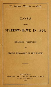
Ye antient wrecke—1626
Subjects:
Download Formats:
Excerpt
The Project Gutenberg eBook of Ye antient wrecke--1626, by Charles W.
Livermore
This eBook is for the use of anyone anywhere in the United States and
most other parts of the world at no cost and with almost no restrictions
whatsoever. You may copy it, give it away or re-use it under the terms
of the Project Gutenberg License included with this eBook or online at
www.gutenberg.org. If you are not located in the United States, you
will have to check the laws of the country where you are...
Read the Full Text
— End of Ye antient wrecke—1626 —
Book Information
- Title
- Ye antient wrecke—1626
- Author(s)
- Livermore, Charles W., Crosby, Leander
- Language
- English
- Type
- Text
- Release Date
- May 14, 2023
- Word Count
- 15,413 words
- Library of Congress Classification
- F001
- Bookshelves
- Browsing: History - American, Browsing: History - General
- Rights
- Public domain in the USA.
Related Books
Cape Cod
by Mitchell, F.
English
150h 23m read

The Wardens of Cape Cod
by Beston, Henry
English
89h 31m read
Shipwrecks on Cape Cod
by Small, Isaac M. (Isaac Morton)
English
427h 38m read
The Pilgrim fathers of New England
by Martyn, W. Carlos (William Carlos)
English
1712h 45m read

The tragedy of Monomoy Beach
by Bearse, Clarkson P. (Clarkson Paine)
English
233h 57m read
Debts hopeful and desperate
by McIntyre, Ruth A.
English
451h 20m read